
13 Oldest Roads in the US and Their Historic Significance
America’s oldest roadways tell stories of our nation’s growth, connecting communities and shaping history long before modern highways existed.
These ancient paths began as Native American trails, evolved into colonial trade routes, and eventually became the foundations of our modern transportation system.
From Revolutionary War troops to westward pioneers, each road carries centuries of American stories.
1. Boston Post Road (1673)
Connecting Boston to New York City, this vital colonial mail route transformed communication in early America. Postal riders galloped through dense forests and marshy wetlands, delivering crucial correspondence between growing settlements.
The road later became a military lifeline during the Revolutionary War, with messengers racing along its path carrying battle plans and troop movements. Today, segments of US-1 follow this historic path, though modern travelers rarely realize they’re cruising along America’s first mail highway.
2. King’s Highway (1650s)
Stretching nearly 1,300 miles from Boston to Charleston, this ambitious colonial thoroughfare united America’s eastern seaboard. Royal decree established this road, demanding colonies maintain sections within their borders – though compliance varied wildly.
During the Revolution, both British and Continental armies relied on this route for troop movements. Parts of modern US-1 and US-17 trace its historic path.
The road’s construction marked a major colonial infrastructure project, foreshadowing the future united nation.
3. El Camino Real (1680s)
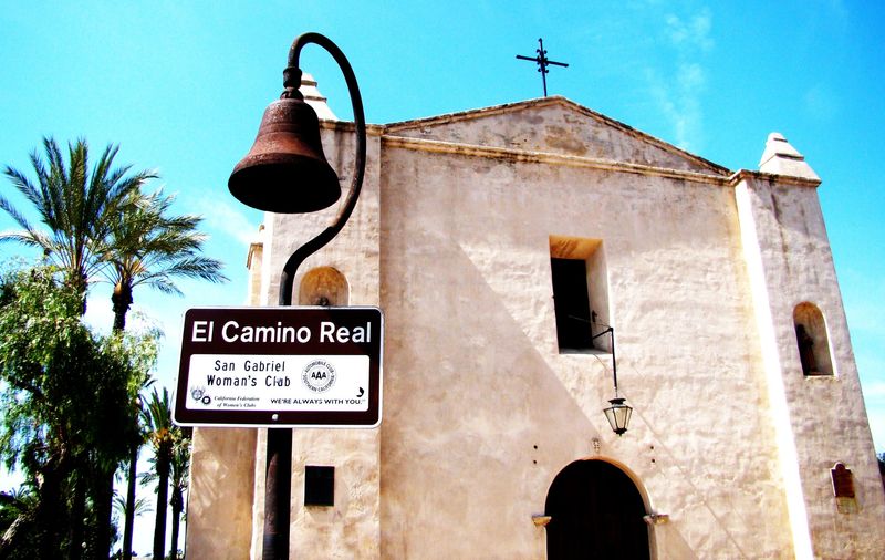
Spanish for “Royal Road,” this legendary trail connected California’s 21 missions long before America claimed the territory. Franciscan monks trudged between missions, establishing European presence while displacing native communities.
Bell markers still dot the route today, guiding travelers along what’s now mostly Highway 101. The road’s history reveals both religious ambition and colonial conquest.
Native Americans were forced to build and maintain sections, while Spanish soldiers patrolled its length, creating a complex legacy of faith, oppression, and cultural exchange.
4. Great Wagon Road (1730s)
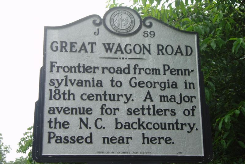
German and Scots-Irish immigrants forged this inland superhighway from Philadelphia into the southern backcountry. Wagons groaned under heavy loads while families walked alongside, pursuing dreams of affordable farmland away from coastal settlements.
The road became America’s most traveled route in the mid-1700s, funneling European settlers into the frontier. Native American trails formed its foundation, though their creators received no credit.
Sections evolved into modern highways including US-11 and I-81, carrying travelers who rarely realize they’re following pioneer footsteps through the Great Appalachian Valley.
5. Natchez Trace (Pre-1700s)
Originally trampled by buffalo and indigenous travelers, this ancient path connects Nashville to Natchez. “Kaintucks” – frontier merchants – floated goods downriver to New Orleans, then sold their flatboats for lumber and walked home along this rugged wilderness trail.
Notorious for bandits who preyed on returning merchants carrying payment gold, the Trace earned a dangerous reputation. President Jefferson later authorized its improvement into a proper road.
Today’s 444-mile Natchez Trace Parkway preserves this historic corridor, offering modern travelers a glimpse into America’s wild frontier days.
6. National Road (Cumberland Road) (1811)
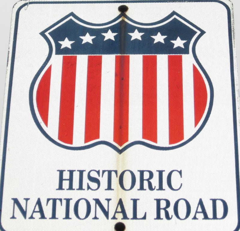
America’s first federally-funded highway stretched westward from Cumberland, Maryland, opening the Ohio Valley to settlement. Construction crews battled wilderness conditions to create a 20-foot-wide thoroughfare that could handle heavy wagon traffic.
Mile markers and toll houses punctuated the route, collecting fees from travelers to fund maintenance. The road represented young America’s commitment to infrastructure and westward expansion.
Now known as US-40, sections still retain original stone bridges and engineering features, though today’s travelers zoom past at speeds early users could never have imagined.
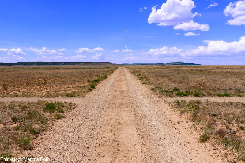
7. Santa Fe Trail (1821)
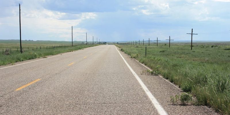
Merchant William Becknell blazed this 900-mile trading route connecting Missouri to lucrative Mexican markets in Santa Fe. Wagon trains loaded with American goods braved scorching deserts and mountain passes, returning with silver and valuable trade items.
Travelers faced Comanche and Apache raids, brutal weather, and mechanical breakdowns along the challenging route. The trail helped cement American presence in the Southwest before the Mexican-American War.
Wagon wheel ruts still scar prairie landscapes along the route, visible from aerial views – permanent reminders of commerce’s power to shape national boundaries.
8. Oregon Trail (1830s)
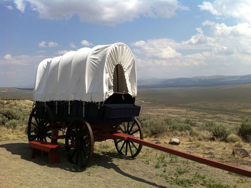
Pioneers seeking farmland in Oregon’s fertile valleys created this epic 2,170-mile journey across the continent. Families packed entire lives into covered wagons, facing river crossings, mountain passes, and harsh weather during the six-month trek.
Disease claimed many travelers – roughly one grave marks every 100–150 yards of the trail. Despite hardships, approximately 400,000 settlers traveled this route between 1840-1860.
The trail facilitated America’s “Manifest Destiny” expansion to the Pacific, though at tremendous cost to indigenous peoples whose lands were crossed and claimed.
9. Wilderness Road (1775)
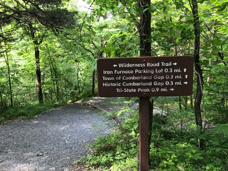
Daniel Boone hacked this path through Cumberland Gap, creating a pivotal route into Kentucky’s frontier. Thousands of settlers followed Boone’s blazes, transforming the dangerous game trail into America’s western migration route.
Native American resistance made travel perilous – many early travelers perished in ambushes. The road revolutionized western settlement patterns, allowing families to bring wagons loaded with household goods into previously inaccessible territories.
Modern US-25 roughly follows this historic path, though today’s travelers zip through mountains that once required weeks of dangerous travel.
10. Lincoln Highway (1913)
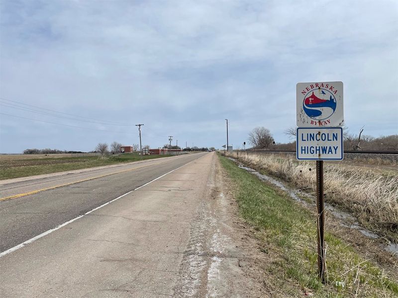
America’s first transcontinental automobile road stretched 3,389 miles from New York to San Francisco. Unlike earlier roads focused on horses and wagons, this route was designed specifically for the revolutionary new technology of cars.
Concrete markers with Abraham Lincoln’s profile guided motorists across states with wildly varying road conditions. Early travelers packed repair kits, food supplies, and camping gear – hotels and service stations were sparse.
The highway sparked America’s car culture and inspired the later interstate system, though its winding path through small towns contrasts with today’s efficiency-focused expressways.
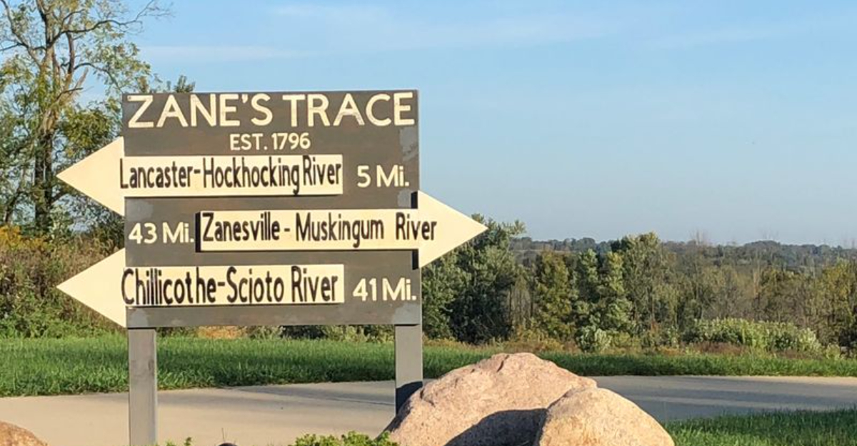
11. Zane’s Trace (1796)
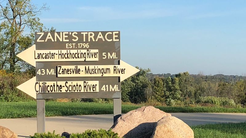
Revolutionary War veteran Ebenezer Zane carved this crucial pioneer road through Ohio’s wilderness, connecting Wheeling to Maysville. The government paid him with land grants at river crossings, where he established profitable ferries and trading posts.
The narrow trail – initially just wide enough for packhorses – opened the Northwest Territory to settlement. Towns sprang up along its path, including Zanesville, named for its creator. Parts of US-22 and US-40 follow the original route.
The road transformed Ohio from frontier wilderness to settled territory within a single generation, accelerating America’s westward expansion.
12. Old Spanish Trail (1829)
Mexican trader Antonio Armijo pioneered this 1,200-mile trade route connecting Santa Fe to Los Angeles through some of North America’s harshest terrain. Pack mules carried woolen goods westward and returned loaded with prized California horses and mules.
The route crossed areas now spanning six states and some of America’s most formidable deserts, including the Mojave. Native American guides were essential for finding water sources along the parched route.
Unlike many historic trails that evolved into highways, much of this path remains undeveloped, preserving archaeological sites and allowing modern adventurers to experience the challenging landscape much as early traders did.
13. Gila Trail (1840s)
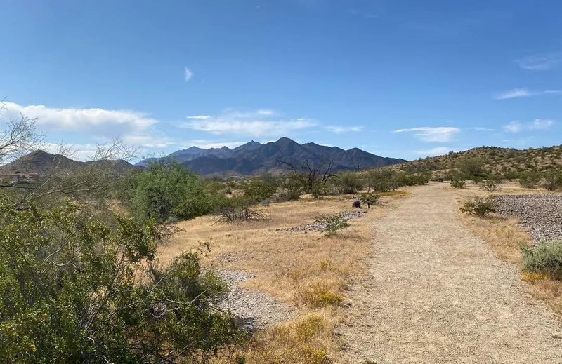
Gold-seeking ’49ers blazed this southern route to California, choosing desert heat over dangerous Sierra Nevada winters. The trail followed the Gila River through Arizona, providing crucial water access in an otherwise parched landscape.
Apache warriors frequently raided traveling parties, making military escorts necessary during certain periods. The route later influenced the Gadsden Purchase, as America acquired southern Arizona partly to secure this valuable transportation corridor.
Interstate 8 roughly follows portions of the historic path, carrying modern travelers through landscapes that once challenged even the most determined pioneers.